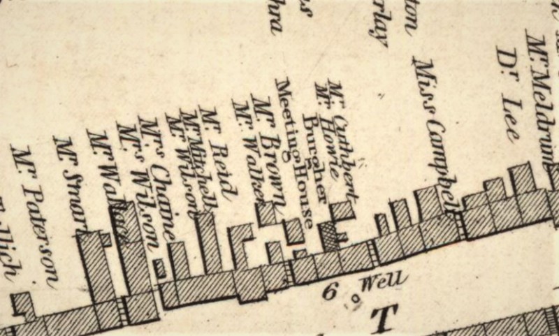
The Burgher Kirk shown in 1820 on John Wood’s plan of St Andrews. (Source: National Library of Scotland, EMS. X.009. Available at: https://maps.nls.uk/view/74400057)
Dublin Core
Title
The Burgher Kirk shown in 1820 on John Wood’s plan of St Andrews. (Source: National Library of Scotland, EMS. X.009. Available at: https://maps.nls.uk/view/74400057)
Contributor
Bess Rhodes
Format
image/jpeg
Type
Still Image
License
In Copyright (InC)
Europeana
Object
https://maps.nls.uk/view/74400057
Europeana Type
IMAGE
Citation
“The Burgher Kirk shown in 1820 on John Wood’s plan of St Andrews. (Source: National Library of Scotland, EMS. X.009. Available at: https://maps.nls.uk/view/74400057),” Virtual Museum, accessed January 28, 2026, https://fifecoastalzone.org/omeka/items/show/132.
Embed
Copy the code below into your web page
