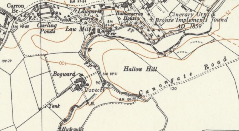
The Hallow Hill area in 1968 before large-scale housing development. The hill is bounded on the north by the Kinness Burn, to the west by the Cairnsmill Burn, and to the south by the medieval Canongate. (Source: Ordnance Survey, Sheet NO 41 NE. Available from the National Library of Scotland: https://maps.nls.uk/view/188141295)
Dublin Core
Title
The Hallow Hill area in 1968 before large-scale housing development. The hill is bounded on the north by the Kinness Burn, to the west by the Cairnsmill Burn, and to the south by the medieval Canongate. (Source: Ordnance Survey, Sheet NO 41 NE. Available from the National Library of Scotland: https://maps.nls.uk/view/188141295)
Contributor
Bess Rhodes
Format
image/jpeg
Type
Still Image
Europeana
Object
https://maps.nls.uk/view/188141295
Europeana Type
IMAGE
Citation
“The Hallow Hill area in 1968 before large-scale housing development. The hill is bounded on the north by the Kinness Burn, to the west by the Cairnsmill Burn, and to the south by the medieval Canongate. (Source: Ordnance Survey, Sheet NO 41 NE. Available from the National Library of Scotland: https://maps.nls.uk/view/188141295),” Virtual Museum, accessed January 28, 2026, https://fifecoastalzone.org/omeka/items/show/136.
Embed
Copy the code below into your web page
