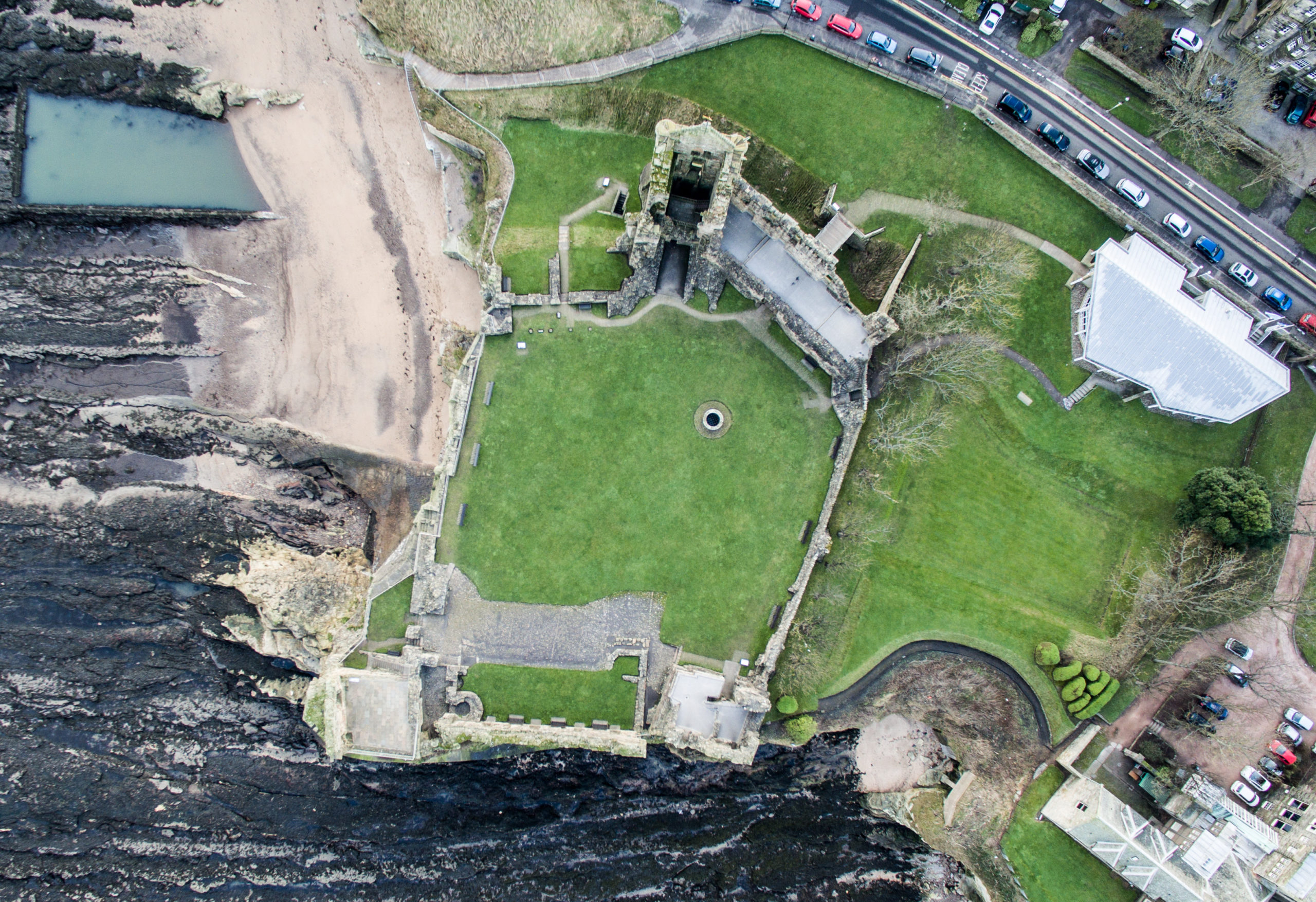
The Changing Coastline
Natural erosion affects many historic and archaeological coastal sites, which are also under pressure from human impacts and climate change. This project uses drone technology to monitor change at some of Fife’s most vulnerable historic coastal sites. We are using a drone equipped with a highly accurate geographic positioning system and a multispectral camera to build up a timeline of repeat photographs of sites. We use this imagery to measure rates of erosion upon our coastal heritage and look for patterns in changes in their condition. Having this kind of data enables us to tackle questions such as how land use and climate change are affecting the processes that cause erosion to sites, both now and in the future.