Fife’s demographic and economic context
Population 2019: 373,550 Projected Population 2030: 370,942 Land Area (hectares): 132,485.97
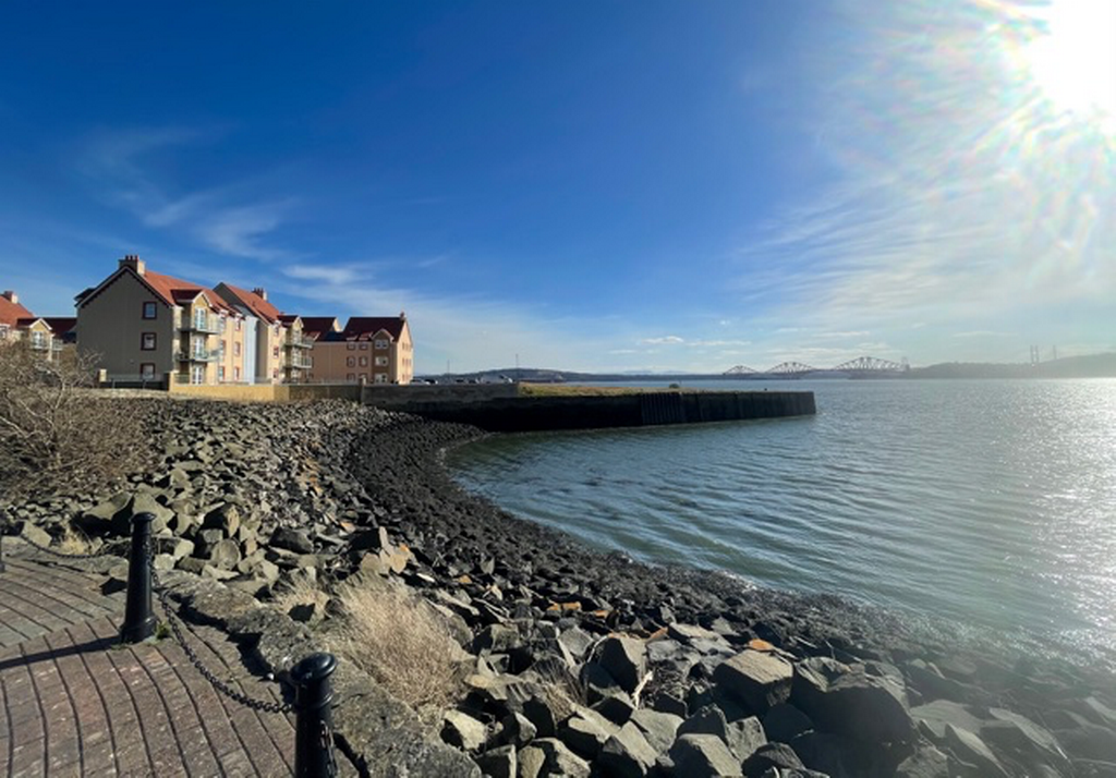
The Kingdom of Fife occupies the peninsula formed by the Firth of Forth to the South and the Firth of Tay to the north. It isn’t an island but until relatively recent times you needed a ferry or a long detour to reach it from most other parts of Scotland.
There are several key bridges that link Fife. The Forth Rail Bridge was completed in 1890. The first Kincardine Bridge was constructed in 1936. This displaced Stirling as the location of the furthest downstream road bridge over the Forth. This was itself displaced by the completion of the Forth Road Bridge linking North Queensferry and South Queensferry in 1964. A further bridge across the Firth of Forth, the Queensferry Crossing, was completed in 2017. The Tay Road Bridge was completed in 1966.
The coal mining industry was prominent in Fife with the first industrial pits opening in the 1800s and the last pit closing in 1988. At its peak there was a large number of pits operating across Fife. The closure of the pits led to significant decline in some areas, which are still working on regeneration.
There have been several ‘new towns’ in Fife, which were developed in the latter half of the 20th century. The biggest example is Glenrothes. This has attracted a range of modern manufacturing and service industries, a trend that continues around the M90 as businesses seek to benefit from the proximity to Edinburgh without the capital’s land prices.
Along the coast, fishing and shipbuilding were significant industries throughout recent history. Both of these are either in decline or have now ceased. Tourism is an increasing industry for some coastal areas in Fife, others are falling into larger spanning commuter belts.
According to the BVI, 14% of data zones in Fife are included in the most vulnerable 20%. That equates to 54,280 people, which is joint fifth (along with North Lanarkshire) highest amount of people in a local authority to be within this group.
Below is a table illustrating demographic and economic data for each of 6 ward case studies in the context of Fife and, where possible, Scotland and the UK.
Table 1. Demographic and Economic Statistics for the Six Ward Case Studies, Fife and Scotland
| Indicator | Period | Rosyth | Inverkeithing and Dalgety Bay | Buckhaven, Methil and Wemyss Villages | East Neuk and Landward | St Andrews | Tay Bridgehead | Fife | Scotland |
| Population | 2019 | 15,902 | 17,493 | 18,079 | 12,272 | 19,702 | 15,884 | 373,550 | 5,463,300 |
| Births | 2018 | 147 | 112 | 235 | 93 | 74 | 132 | 3,479 | 51,308 |
| Deaths | 2017 | 143 | 161 | 257 | 164 | 155 | 145 | 4,141 | 57,290 |
| % of population aged 16-64 | 2017 | 65.1 | 60.8% | 61.0 | 58.8 | 75.6 | 64.0 | 62.6 | 64.4 |
| Children receiving child benefit | 2018 | 2985 | 2,875 | 3,810 | 1,825 | 1,110 | 2,510 | 919,430 | |
| Mean House Price | 2018 | 127,619 | 187,602 | 84,902 | 228,718 | 337,680 | 198,686 | 158,698 | 181,457 |
| Median House Price | 2018 | 106,268 | 152,000 | 75,529 | 193,025 | 290,000 | 171,000 | 135,000 | 152,500 |
| Total number of dwellings | 2019 | 7,080 | 8,189 | 9,771 | 7,506 | 7,549 | 7,073 | 178,650 | 2,645,950 |
| Dwellings per hectare | 2017 | 2.52 | 4.76 | 3.58 | 0.39 | 1.73 | 0.66 | 1.33 | 0.33 |
| % Women recorded as smokers at ante-natal booking | 2017-19 | 18.24 | 8.42 | 34.35 | 14.55 | 9.50 | 9.32 | 18.88 | 14.40 |
| % Babies born with low birthweight | 2017-19 | 2.28 | 1.77 | 4.23 | 3.54 | 1.08 | 1.69 | 2.15 | 2.02 |
| % adults with long term limiting physical or mental health condition | 2016-19 | 24.70 | 25.10 | 33.70 | 34.60 | 19 | 20.90 | 27.80 | 24.70 |
| % adults who provide unpaid care | 2016-19 | 16.40 | 19.40 | 11.80 | 13 | 11.10 | 10 | 15.50 | 17.20 |
| % adults with good or very good general health (self-assessed) | 2016-19 | 75 | 73.10 | 63.10 | 73.60 | 86.90 | 75.80 | 70.60 | 73 |
| % Current Smokers | 2016-19 | 20.40 | 12.40 | 26.20 | 18.10 | 9.40 | 14.10 | 18.90 | 18.20 |
| Land Area (hectares) | 2,814.07 | 1,720.17 | 2,732.69 | 19,321.27 | 4,372.02 | 10,666.77 | 132,485.97 | 7,793,711.08 |